
According to Vacation Idea, “Park City, Utah, located about 32 miles from Salt Lake City, is known for its excellent ski resorts and the popular annual Sundance Film Festival.” However, it is well known for the hiking trails around Park City. The resort offers more than 400 miles of public trails, ideal for hiking and biking through dense mountain forests, hot springs, and reservoirs. From scenic strolls to adrenaline-raising terrain, Park City is an excellent destination for outdoors enthusiasts.
Hiking Trails Around Park City
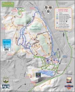
Round Valley
Beginner to Intermediate
This hiking and biking complex is located on the eastern edge of Park City, near US-40 on Kearns Blvd. The trails are well-marked, and some trail intersections include trail maps.
Ambush Trail
Mixed use. More difficult.
1200 feet of elevation gain. Departs from the base area via the service road, climbs towards the Super Condor Express lift, and meanders through some switchbacks until meeting up with Short Swing or continuing to the Mid Mountain trail.
Short Swing Trail
Mixed use. More Difficult.
This is a connector trail that hooks up with Holly’s and Ambush. The trail takes you through a beautiful section of the resort.
Mid Mountain Trail
Mixed use. More difficult.
This trail meanders through the resort and is a multi-use trail. The south section of the trail is more flat and mellow, while the north section of the trail is a classic climb. There are multiple loop options, and you can access the trail via Deer Valley, Armstrong Trail, Spiro, or Sweeney.
Iron Mountain
Mixed use. 3 miles roundtrip.
The trail is accessible via the Mid Mountain trail and winds across Iron Mountain with scenic views of the resort and the town of Park City. The summit is between Park City Resort and the Canyons. Steep and rocky, but worth the views.
Goldfinger
Mixed use. More difficult.
You can get to this trail via Iron Man or Mid Mountain. Full of switchbacks.
Holly’s Trail
Mixed use. Very difficult.
This trail drops 900 feet in about 4 miles (hiking/biking down is preferable). The trail brings hikers and bikers to and from Red Pine Lodge.
Wasatch Ridge Crest Connector
Mixed use. Very difficult.
You can get to this trail via Mid Mountain trail, and it’s a difficult climb that gives you access to the Wasatch Crest trail and upper Mill Creek Canyon. Tough trail, but it’s in the shade all day.
Silver Lake Trail
2.25 miles one way.
This trail starts near the Silver Lake Lodge ski lift and leads hikers through aspens and pine trees with views that open up when you cross ski runs. The trailhead and trail are clearly marked.
Blackhawk to Stealth Loop at Glenwild
Difficulty: Moderate
Length: 5.5 miles
Elevation Gain: 722 feet
Type: Loop
Features: Perfect way to explore the Swaner Nature Preserve, great early/late season trail that is easily accessed.
Difficulty: Moderate
Length: 2.8 miles
Elevation Gain: 465 feet
Type: Out and Back
Features: pristine high alpine lake
Difficulty: Moderate
Length: 3.8
Type: Loop
Features: Shade, stream, and great views of some of Park City’s historic mines.
Glenwild Loop
8.5 miles.
Located across I-80 from Kimball Junction, this trail is excellent for hiking and trail running.
Union Pacific Rail Trail
“Beware, while the grade is not steep – being an abandoned rail line – it is constant so
e-bikes are recommended.”
Trail Etiquette and Safety
Park City is truly a mecca for the outdoor enthusiast, boasting year-round adventures. During the winter, skiing is king, and when the snow melts, it’s our trails that become top tier. Understanding the rules of road or trail, in this case, is the first step before stepping out on the trail.
While Utah.com is the very best source for Utah travel related information, several free publications are available. You can request one or more by clicking on the link above the form below. You will receive the publications via snail mail.


